 INNOVATION AND R&D
Born from a research and development project led by EADS Astrium (today Airbus DS Geo), then from a pilot initiative led in partnership with BRL and Météo France, R&D is part of the quintessence of PREDICT Services. Since its creation in 2006, PREDICT Services has been a laboratory for research and innovation in climate risk management.
To cope with climate change and the evolution of society, strengthening risk prevention and management is a major challenge for the resilience of territories. Keeping that on mind, we carry out R&D projects in partnership with research institutes, universities, companies, institutions and risk management participants all over the world, in order to jointly advance knowledge of natural phenomena, how to better anticipate them and how to deal with them, exploring new technologies and working on the design of future solutions.
Predict Innove is an annual meeting devoted to R&D and innovation dedicated to the analysis, anticipation and management of meteorological and climatic risks. It brings together experts and specialists in risk management from the public and private sectors, with the same objective: to improve the resilience of territories and everybody who lives there.
The culmination of the results of our research and innovation of the year, Predict Innove is also an opportunity to share ideas, to create new collaborations and to take the pulse of those who manage risks on a daily basis.

 THE R&D PROJECTS CARRIED OUT BY PREDICT ARE PARTICULARLY RELATED TO:


During the first wave of COVID-19 in France, we were challenged by the spatial and temporal heterogeneity of the spread of the virus around the world. It therefore seemed interesting to study a possible correlation between the spread of COVID-19 and the weather.
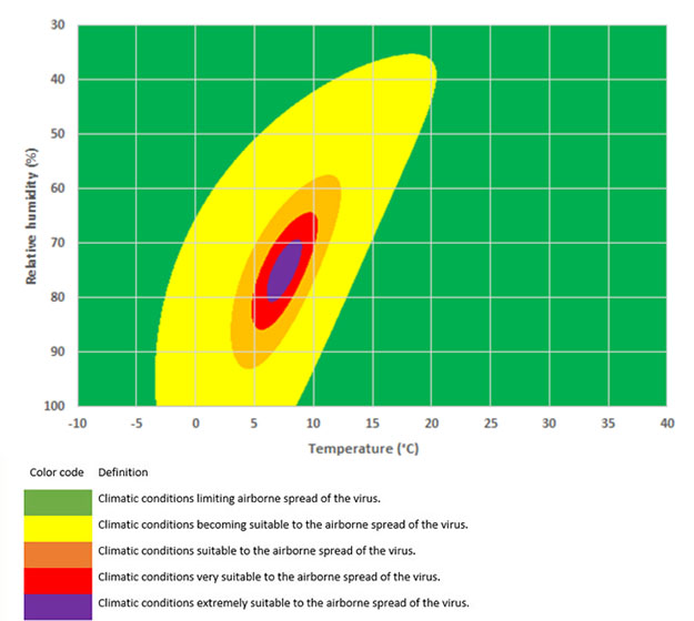
The research culminated to the creation of a specific Index: the IPTCC, acronym in French for Index PREDICT on Climatic Transmissivity of COVID-19, which characterizes the capability of transmission of the virus with regard to the conditions of humidity and temperature of the environment (air).
This R&D project was carried out on the basis of meteorological and epidemiological data available at national and international levels. We worked in close collaboration with many scientific and institutional players, including the Institut Pasteur (French non-profit private foundation dedicated to the study of biology, micro-organisms, diseases, and vaccines.), the Scientific Council (independent advisory organization responsible for counseling French President and other decision-making actors on the fight against COVID-19 pandemic in France), Santé Publique France (national public health agency.), the ANRS (French Agency for Research on AIDS and Viral Hepatitis), the CNRS (French state research organization), the Artificial Intelligence in Health department of the University of Paris, the General Directorate of Health, CovidTracker and Météo France. The objective was to anticipate the periods of the year when the risk of the virus spreading was higher and to integrate these parameters into the strategic decisions taken on the territory to cope with the pandemic.
According to scientists, the sputters and aerosols that we emit when we speak or breathe are the main vectors of transmission of the virus. Once expelled into the air, the evolution of these aerosols depends on local weather conditions.

Specific work carried out in partnership with researchers Hippolyte d'Albis (Paris School of Economics, CNRS) and Dramane Coulibaly (Lumière Lyon 2 University) has demonstrated that the IPTCC makes it possible to predict hospitalizations due to COVID-19. There are particular climatic conditions likely to have caused hospitalizations and deaths during the first two waves of the epidemic. Recognized by the scientific community, this study and its results have been published in the journal Nature: Quantification of the effects of climatic conditions on French hospital admissions and deaths induced by SARS-CoV-2 (nature.com).

Read the article by PREDICT Services on the journal “Médecine de Catastrophe” and see the results of the work carried out.
Read moreIn 2018, we launched the COSPARIN R&D project (acronym in French for Spatial Contribution on Flood Risk Analysis), with funding and support from the European Space Agency (ESA), support from the National Center for Space Studies (CNES) and the technical contribution of Météo-France and CEREMA.
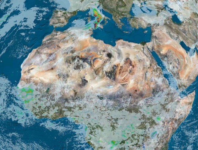
Many places in the world are not covered by radars or do not count with identified flood-prone areas, making it difficult to observe the rainfall phenomena at the origin of floods and thus their prevention. We have thus decided to look for new data, arising from European institutes that could support an everlasting production. COSPARIN makes it possible by producing an estimation on rainfall using satellite imagery as well as the production of flood-prone areas, also designed from space data (those from Airbus DS Geo) and a CEREMA model, all over the world.
The pilot phase of this project takes place in the Indian Ocean islands, giving us a significant technological lead in the detection of risky phenomena and the implementation of warning and prevention systems to cope with flood risks.


Searching for coordination and prioritization, local authorities and crisis management actors must continuously monitor and share the actions carried out in the field as well as to threat this information over time.
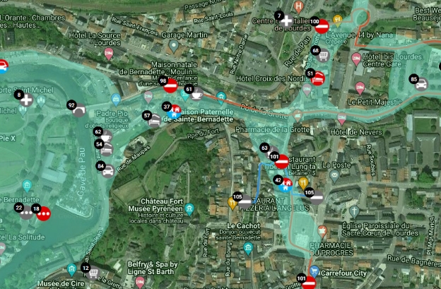
We have enriched our web-platform Wiki-Predict with a new collaborative backup management module, called GECOS (acronym in French for Safeguard Collaborative Management), this function allows players to publish and share the actions taken in real time.
This interactive daybook allows all the services mobilized during a major event to share the actions carried out on the field. They can visualize in real time all the operations already carried out and better identify what remains to be done to safeguard people and infrastructures.
Once the event has passed, GECOS is an excellent tool for feedback.