


 RISK ANALYSIS
 A BETTER KNOWLEDGE OF THE RISK IMPROVING YOUR STRATEGIES AND FACILITIES
 Our risk analysis is based on an assessment of the exposure and vulnerabilities in case of climatic hazards: floods, thunderstorms, storms, storm surge, heavy snowfalls, extreme temperatures, drought, cyclones, but also forest fires, earthquakes, tsunamis, etc.
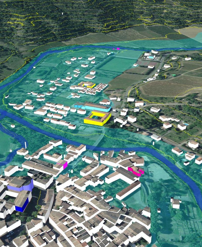
We study the data concerning to hazards and carry out our diagnosis using the PREDICT Analyser® software, a GIS tool specifically developed for the 3D study of territories.
PREDICT ANALYSER® ALLOWS US TO:  Cross-reference geographical data, in particular satellite data;
Define threat zones for each territory;
Characterize the issues located in these zone (housing, sensitive public establishments, roads, etc.);
Estimate the degree of vulnerability of each sector.
This method of assessing the degree of exposure of territories allows the design of preventive organizations, the adaptation of facilities accordingly and to support arbitrations.
 A MULTI-HAZARD EXPERTISE
 Originally, our expertise was targeted at the flood risk, which remains the leading climate risk in France due to the number of territories concerned (16,000 municipalities and 300 agglomerations concerned) and the economic cost that it represents. Since then, we have extended our expertise to all hydrometeorological risks. Nota bene: two thirds of the 36,000 French municipalities are exposed to at least one natural risk.
The projects carried out with our scientific and industrial collaborators have allowed to collect and develop a database and an unique analysis method to qualify risks by hazard, in France and abroad.